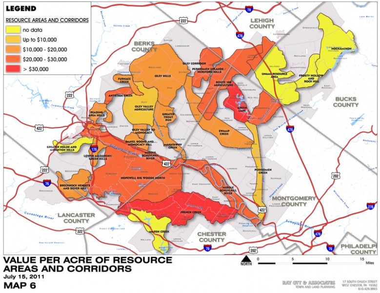
This report was prepared to help advance the conservation goals of the Schuylkill Highland program by providing a demographic profile of population densities and growth characteristic in the study area, along with a basic evaluation of land values and the development potential of parcels within the Schuylkill Highlands nineteen Resource Areas and seven Connection Corridors It was prepared using GIS data provided by Natural Lands Trust, who is overseeing the Schuylkill Highlands project, and tax parcel and assessment data from five counties in the study area: Lehigh, Bucks, Montgomery, Berks and Chester.
Schuylkill Highlands Land Acquisition Analysis